
Here are more aerial images of Campbellton, New Brunswick and area — this time featuring the beautiful fall colours the region is famous for.
The photos were taken in October 2017 using a small drone, the DJI Phantom 4 Pro.
CLICK on the images to see sharp, breathtaking views that’ll fill your screen.
Feel free to download a photo or two — or three — that tug at your heartstrings. You might like one as a SCREEN-SAVER … or for a homesick Downhomer living ‘away.’
At the very end of this post, there’s a short video of Sugarloaf Mountain and its colourful foliage. You have a choice of watching it in different degrees of sharpness: 720p, 1080p … and 2K — the last one being the best.
The same video clip has been posted on YouTube. It’s quite sharp … and beyond cool to view it in 2K in ‘full screen’ mode. It’s like “you’re there.”
Fasten your seat belt … we’re off to a special corner of Canada where nature doesn’t stop smiling.
Remember to click on the photos. [Note: the cover image isn’t clickable, but you can click on it further on in the post.]
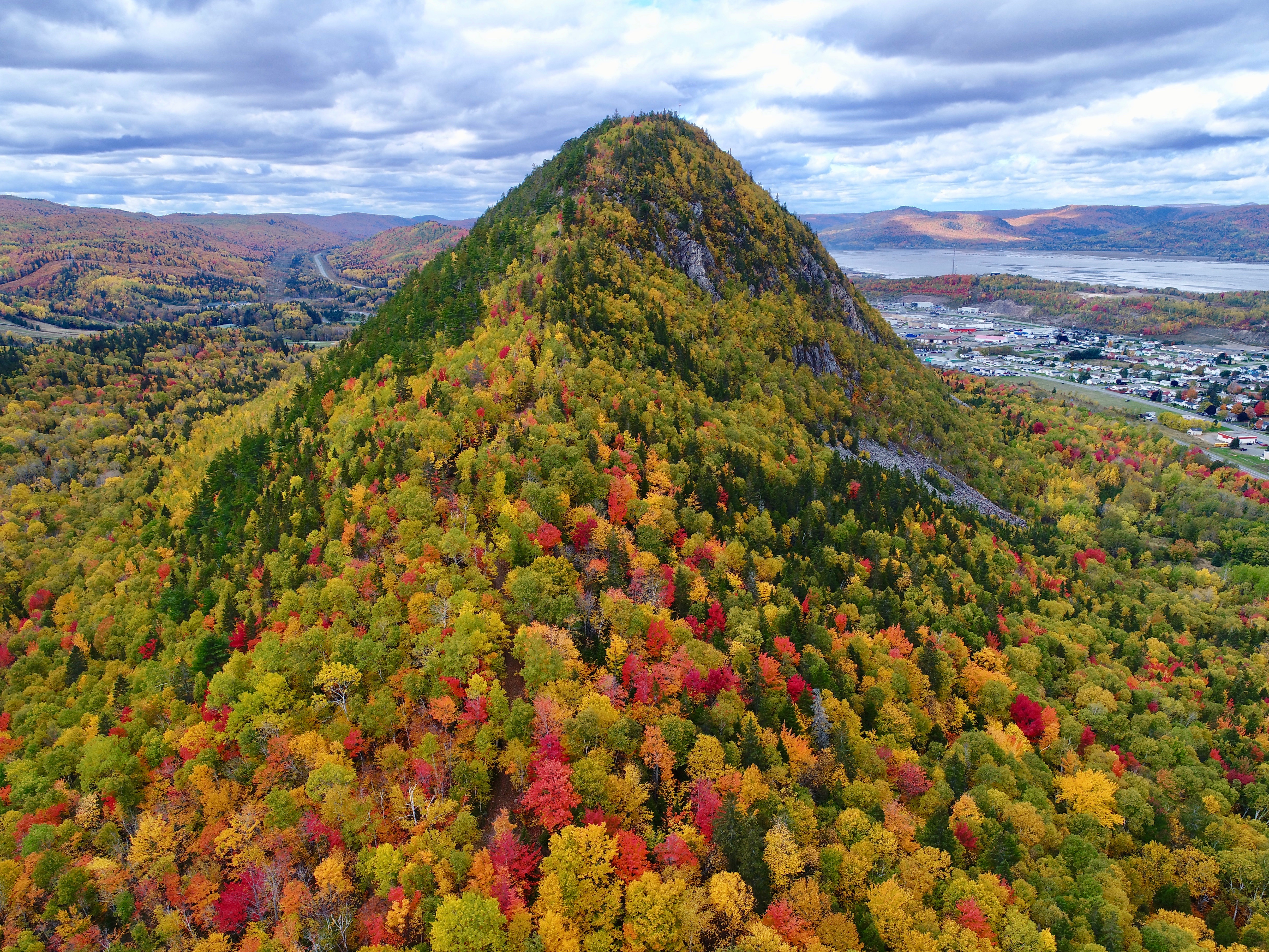
1. The east end of Sugarloaf Mountain with stunning, beautiful fall colours! Can you spot the leaf-covered path? [October 2017]
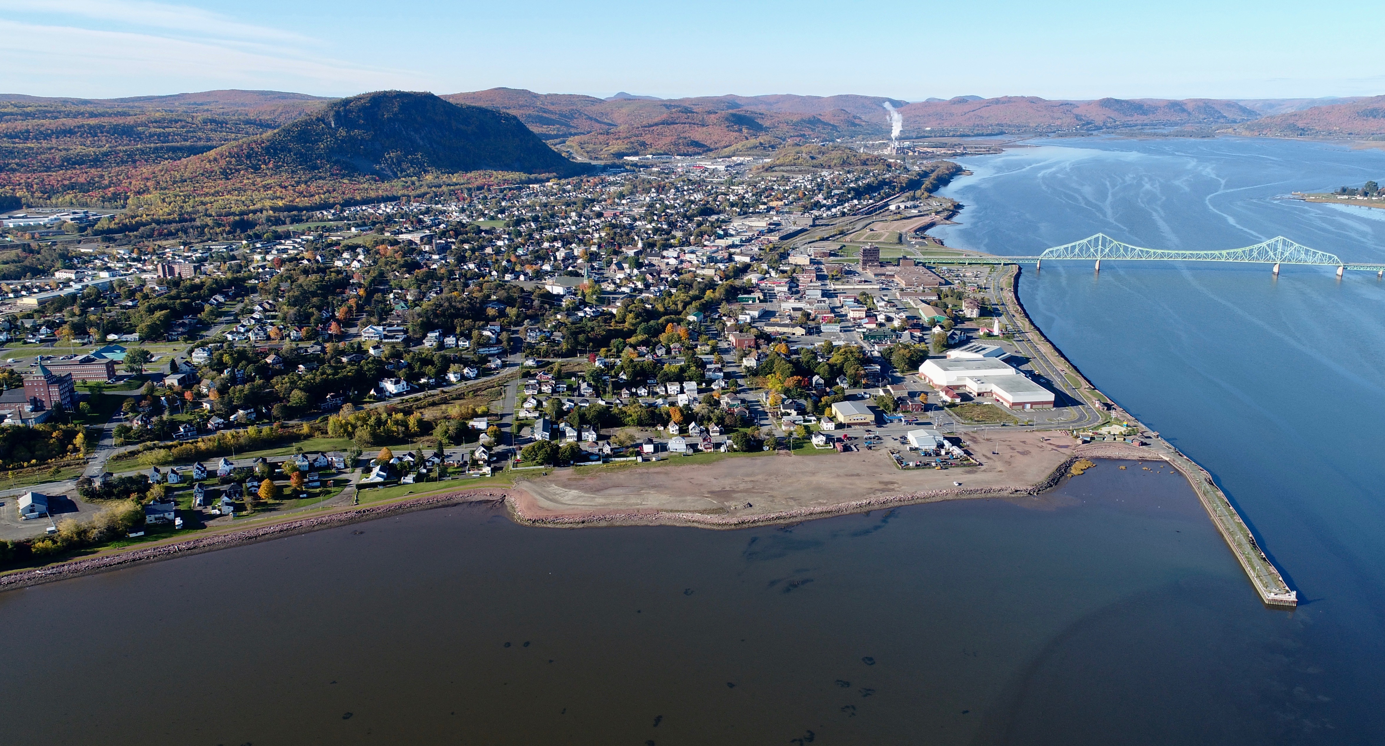
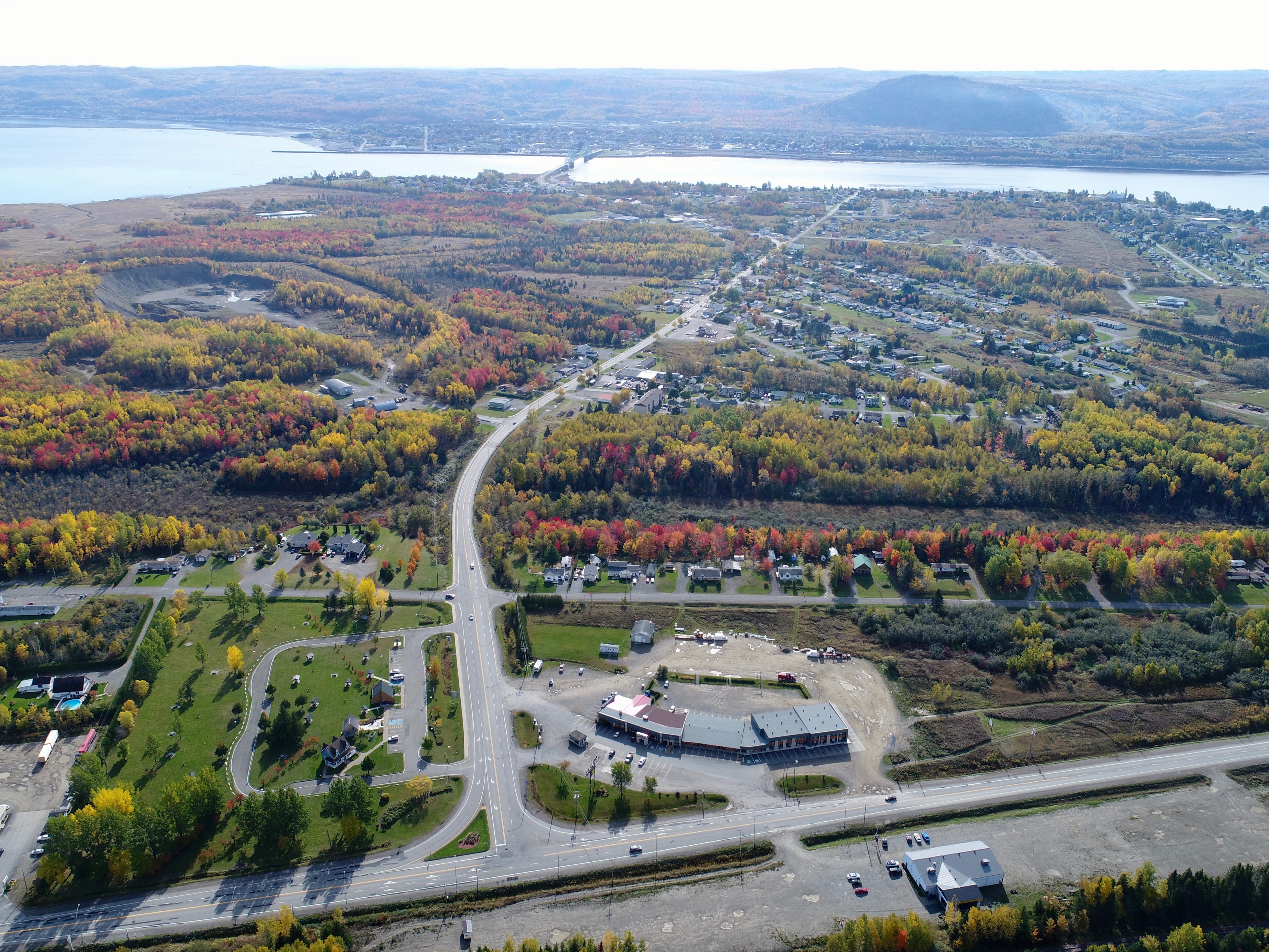
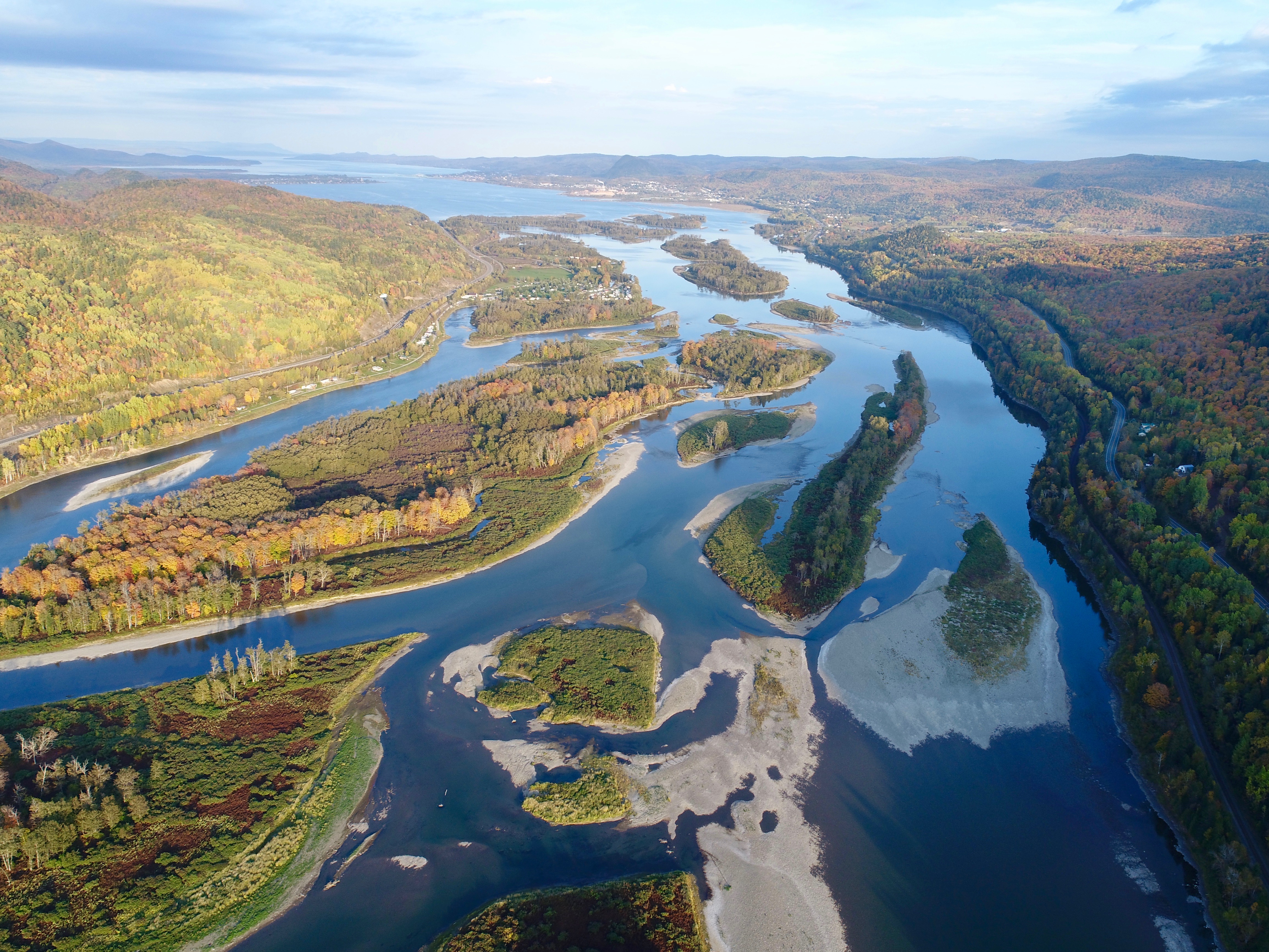
2. Campbellton from high above the Restigouche Estuary [October 2017]
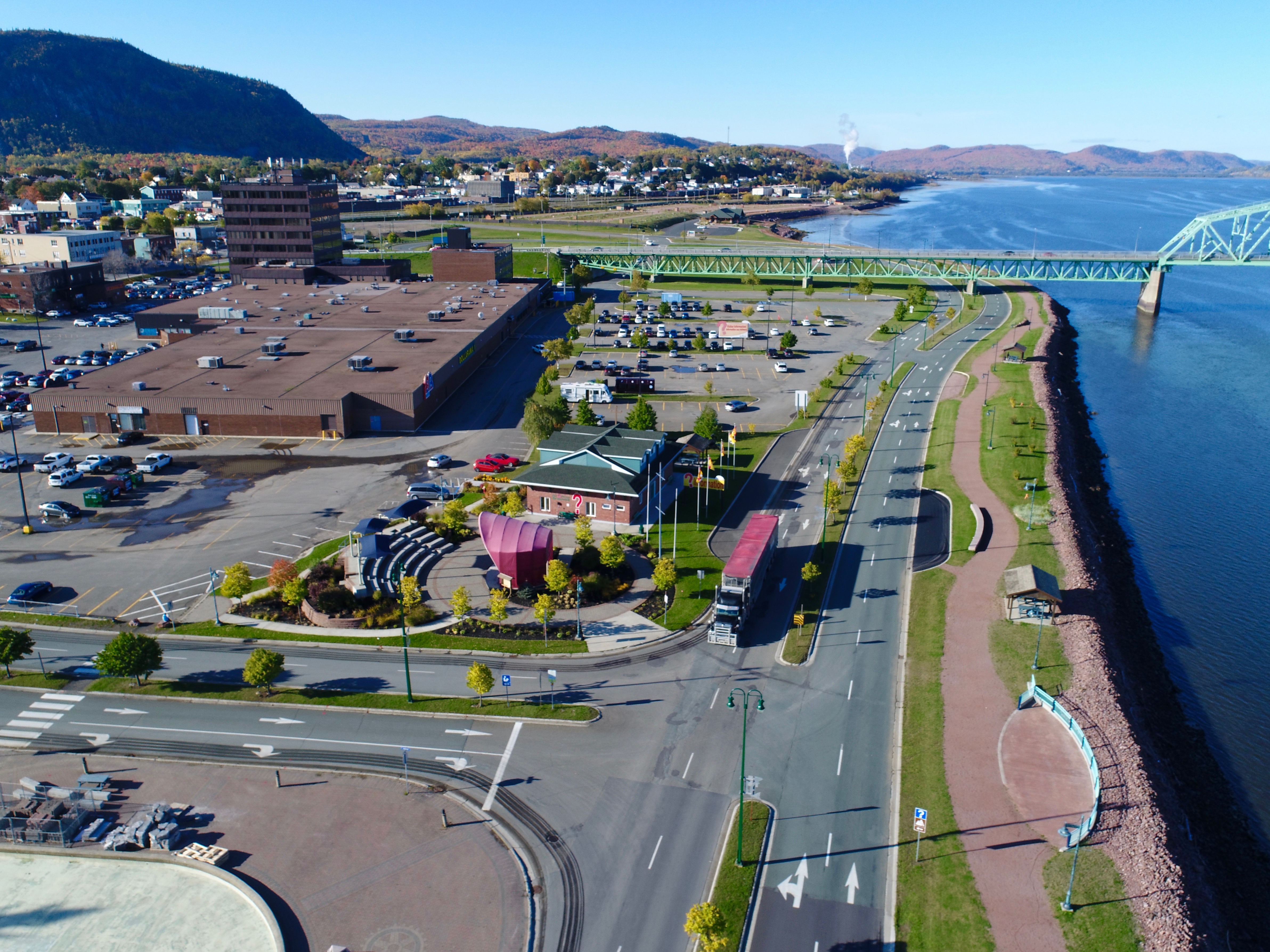
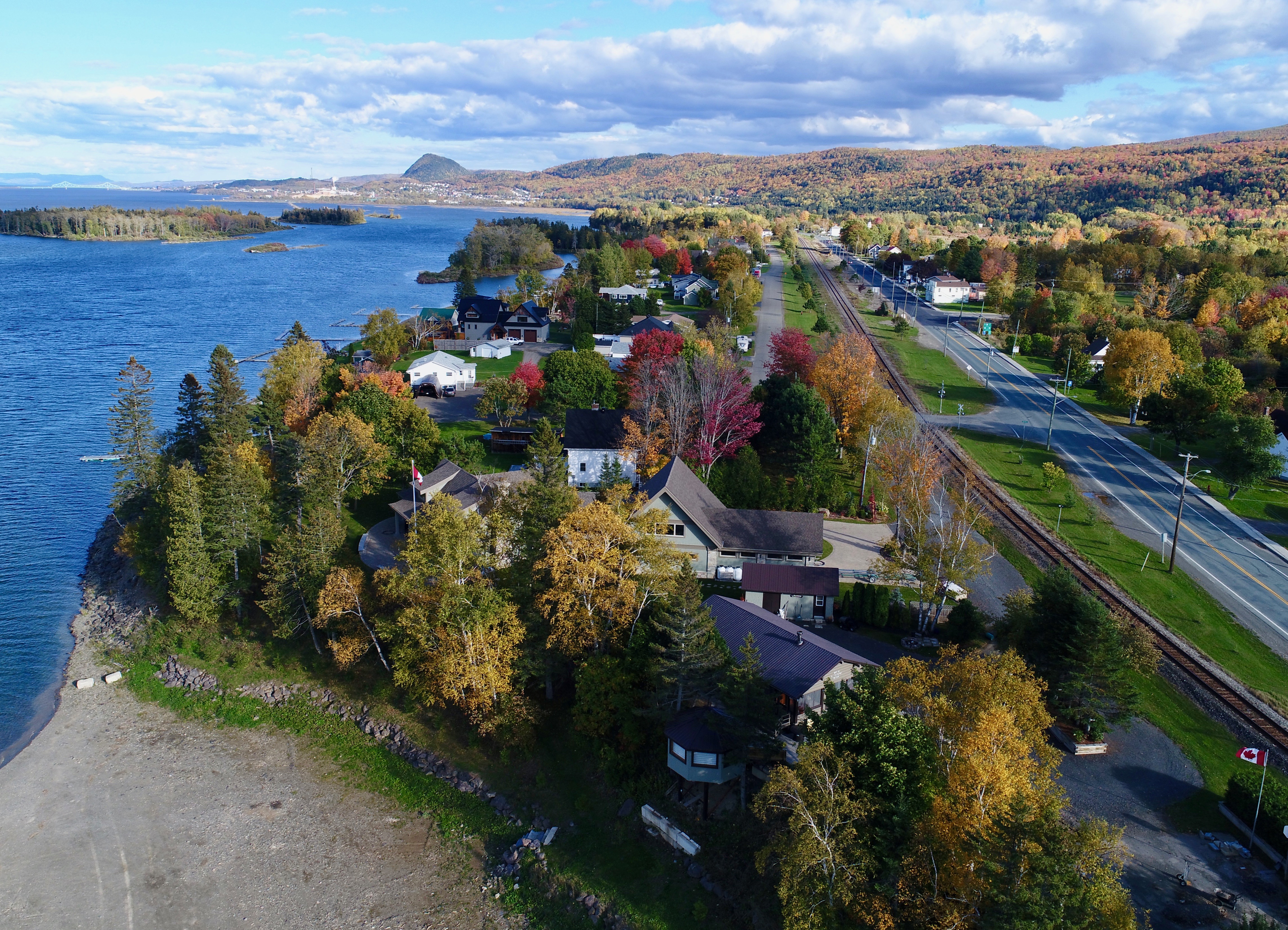
3. Campbellton’s waterfront has been nicely developed since I was a kid … I left in 1967 and we had nothing this nice back then. [October 2017]
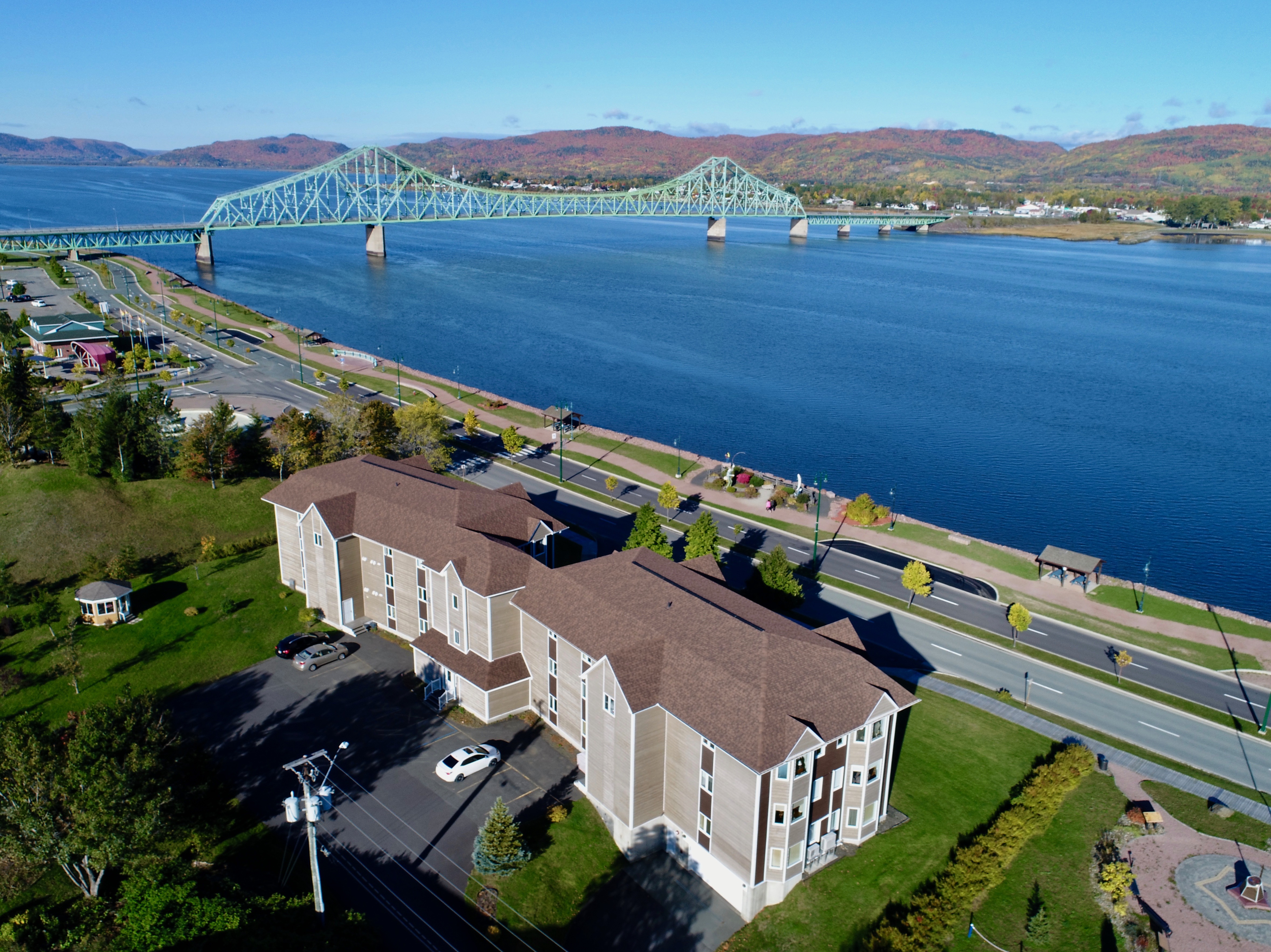
4. An apartment complex right next to Salmon Boulevard with the Charles Van Horne bridge in the background. [October 2017]
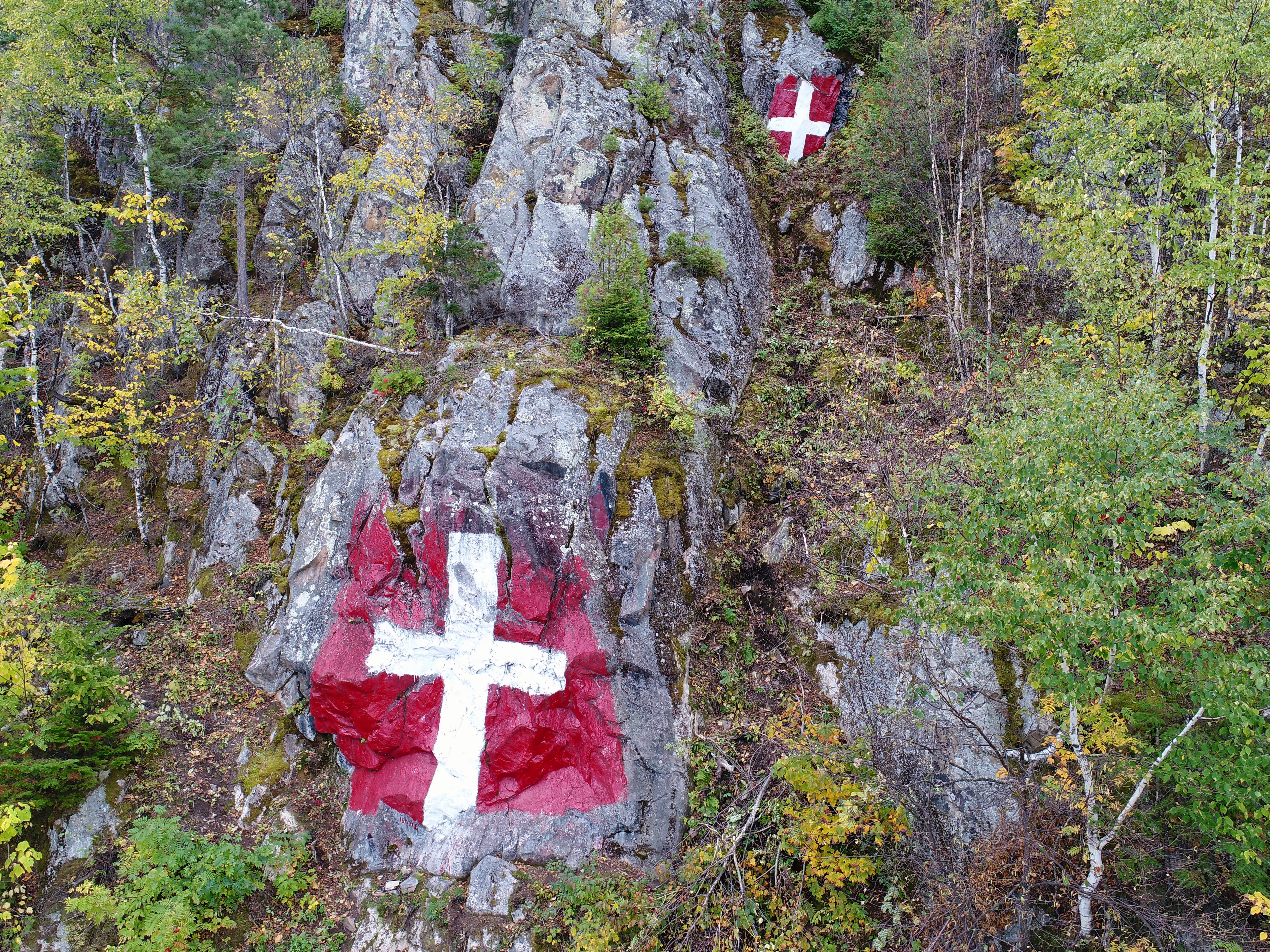
5. The famous crosses on the face of Sugarloaf Mountain — after some trimming of bushes. [October 2017]
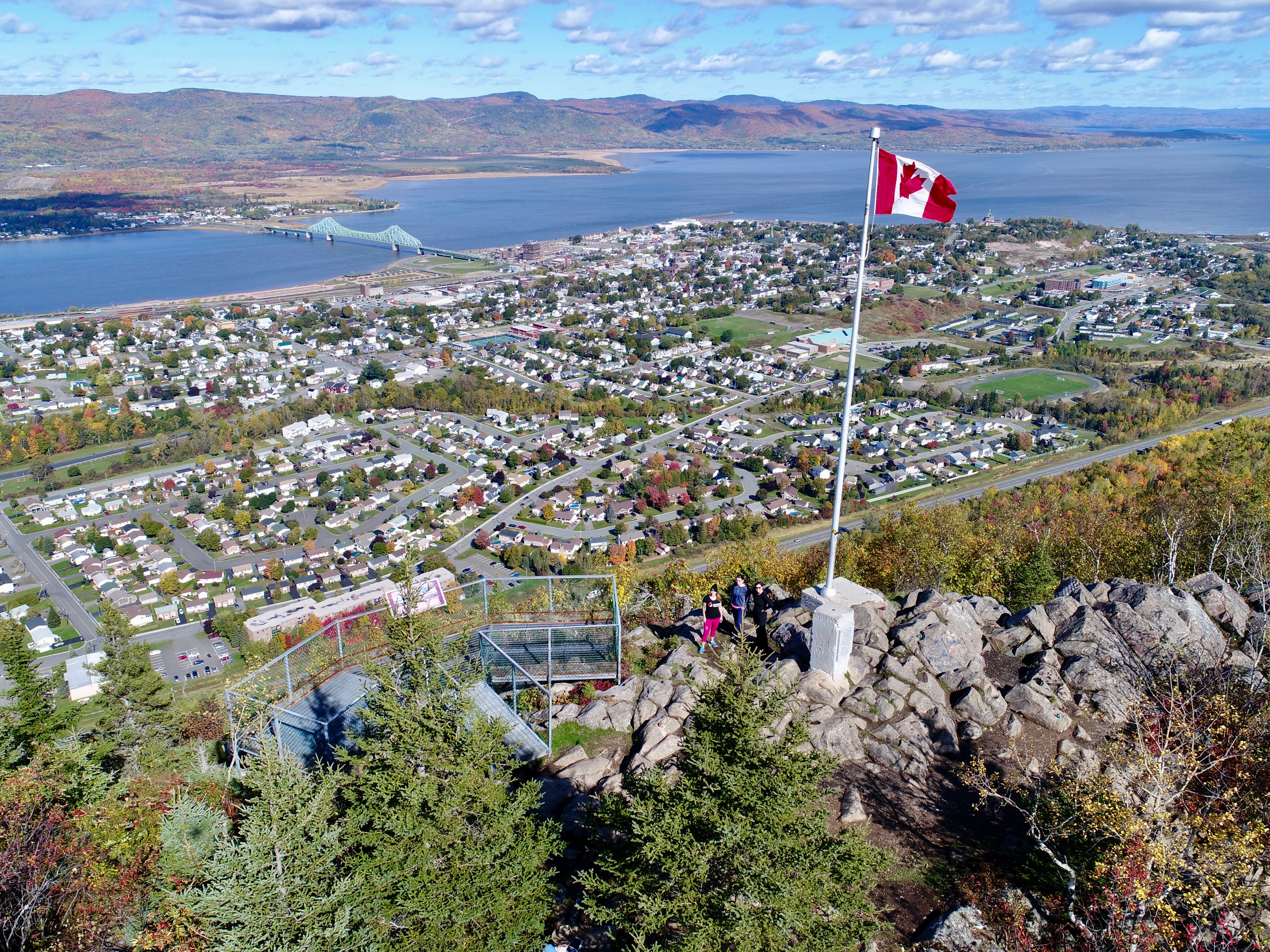
6. Atop Sugarloaf Mountain. Enjoying the view [remember, click to enlarge] are Josee Doucet, Myah Barristo and Alex Jones. [October 2017]
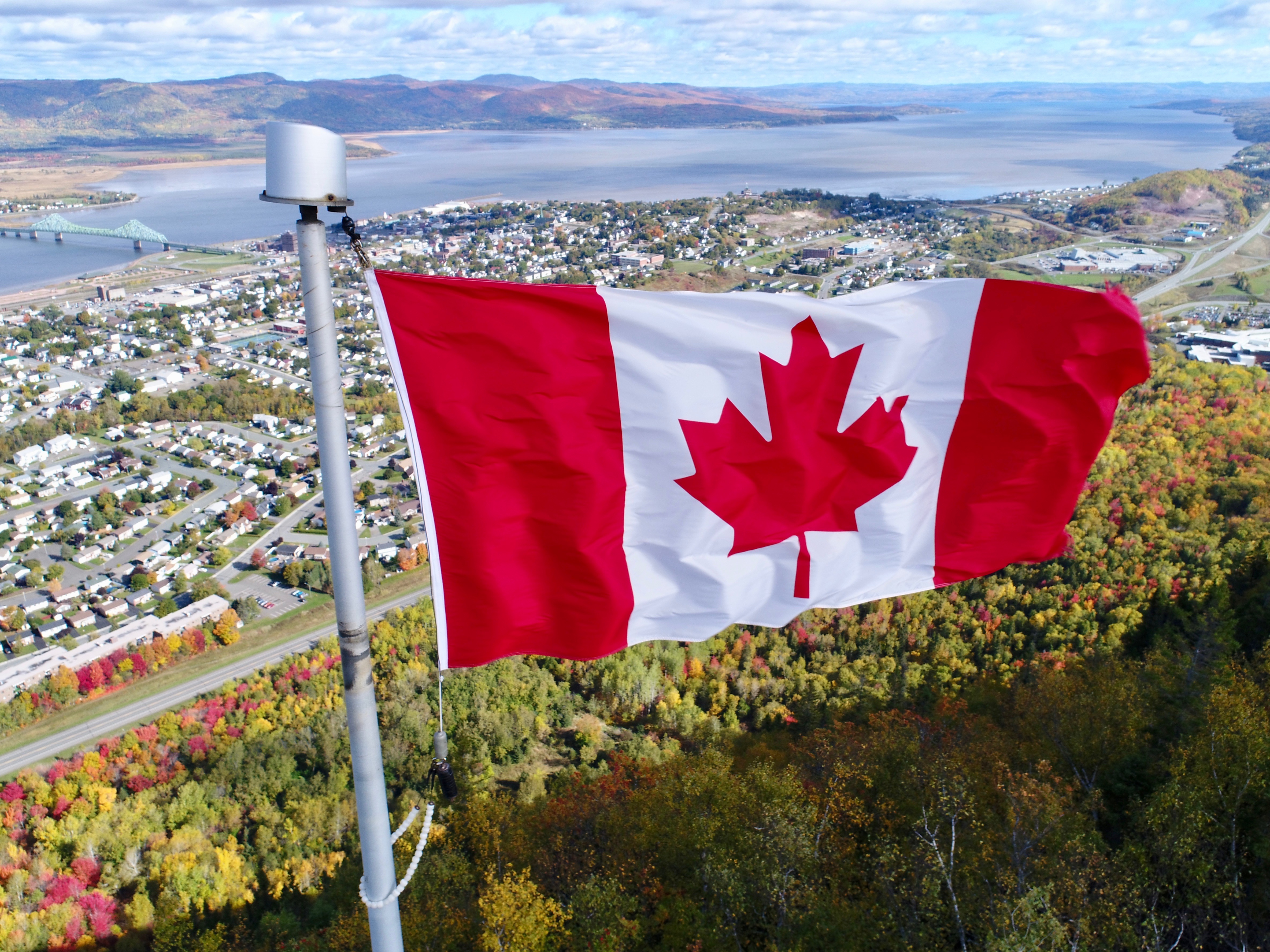
7. The Canadian flag on the Sugarloaf up close. If you’re wondering why the RCMP didn’t put up a larger flag it’s because the flagpole — a donation — isn’t big enough. The flag, flying high above the Sugarloaf, has fast become a Campbellton icon. [October 2017]
8. Spot the viewing platform? [October 2017]
9. There are two flags on the Sugarloaf. Here’s the second, a tattered ensign suspended over a large outcrop of rocks at the eastern end of the mountain. The flag might not be there long. It’s ‘illegal.’ [October 2017]
10. The steel steps that help hikers get to the top of Sugarloaf Mountain. I didn’t realize the staircase was that long. Don’t let this put you off on climbing the path … the staircase isn’t steep like it appears. [October 2017]
10b. Recognize anything down there? It’s the spot where large slabs of stone have been used to make a staircase. This is roughly the halfway point on the trail. [October 2017]
11. Nature puts on a show on the hiking trail up the Sugarloaf [October 2017]
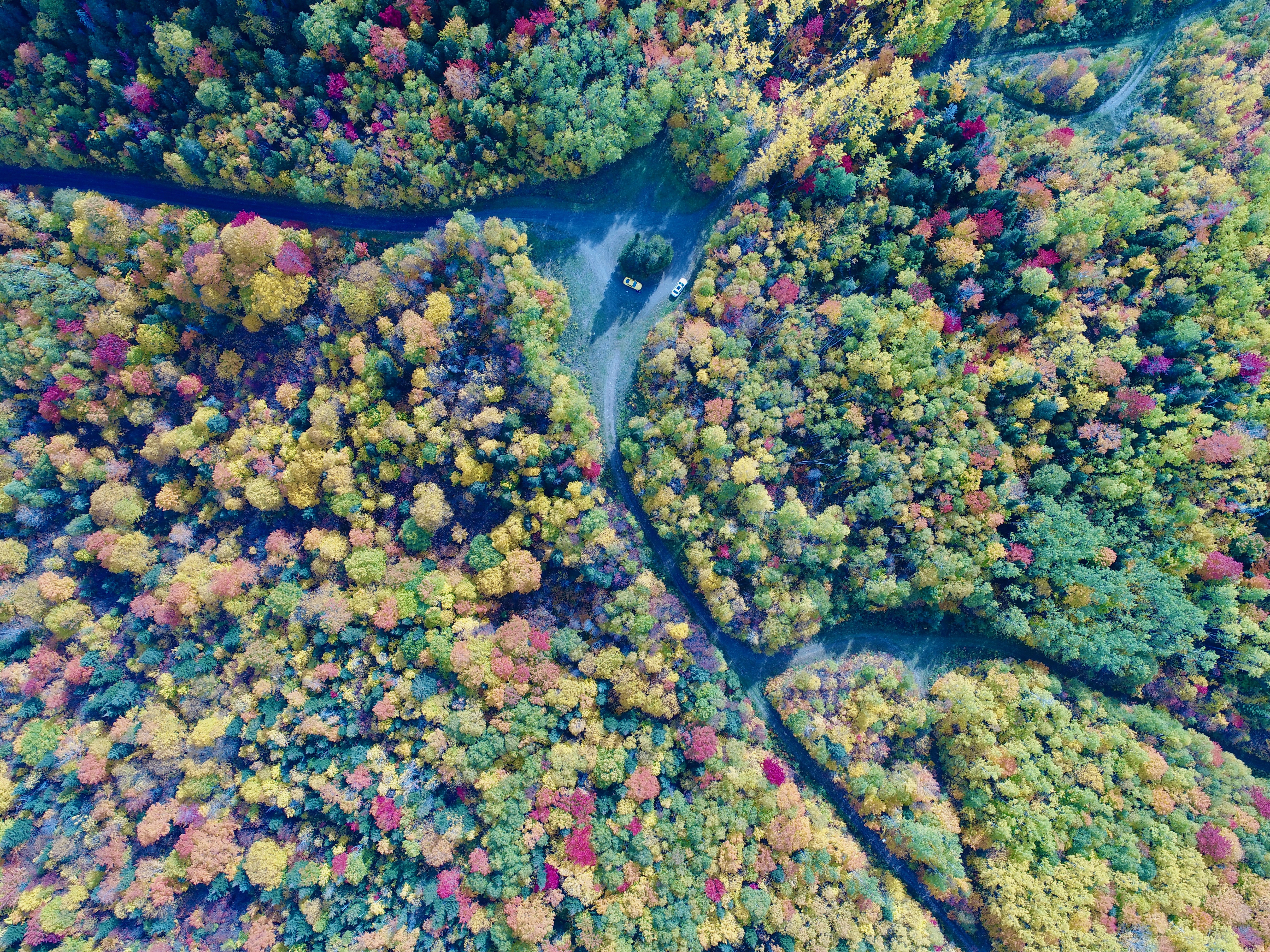
12. The Terry Fox Memorial Trail cuts through a beautiful display of trees about to take a six-month nap. From overhead, it looks like coloured broccoli … or a flower arrangement … or that someone went nuts with photoshop. [October 2017]
13. The Terry Fox Memorial Trail shows the way to Sugarloaf Provincial Park. That strange hill to the right is Sugarloaf Mountain. [October 2017]
Can you spot three people on the Terry Fox Memorial Trail? [October 2017]
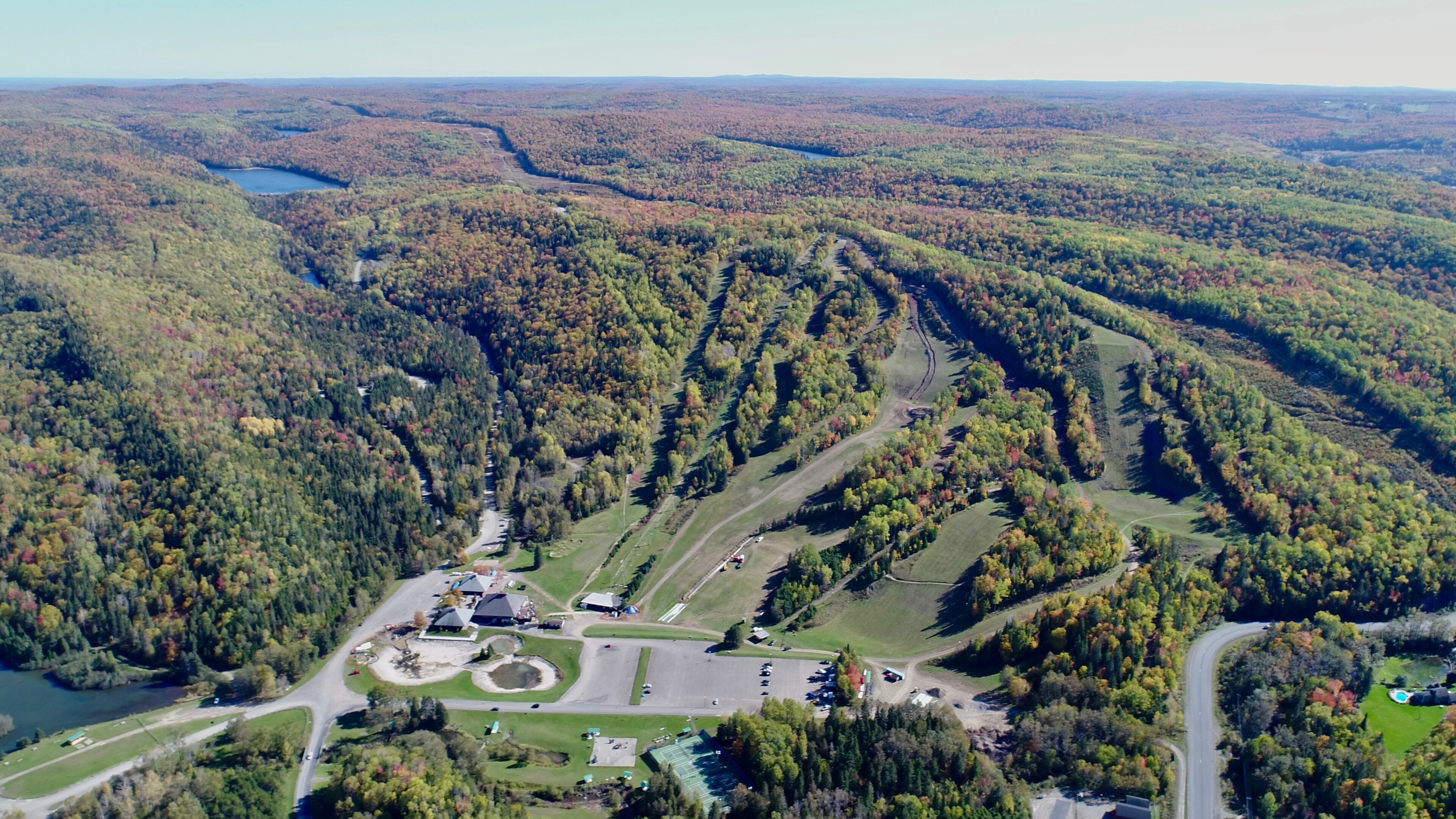
14. The sprawling Sugarloaf Provincial Park complex [October 2017]. The area covered by the park rangers is larger than Campbellton itself.
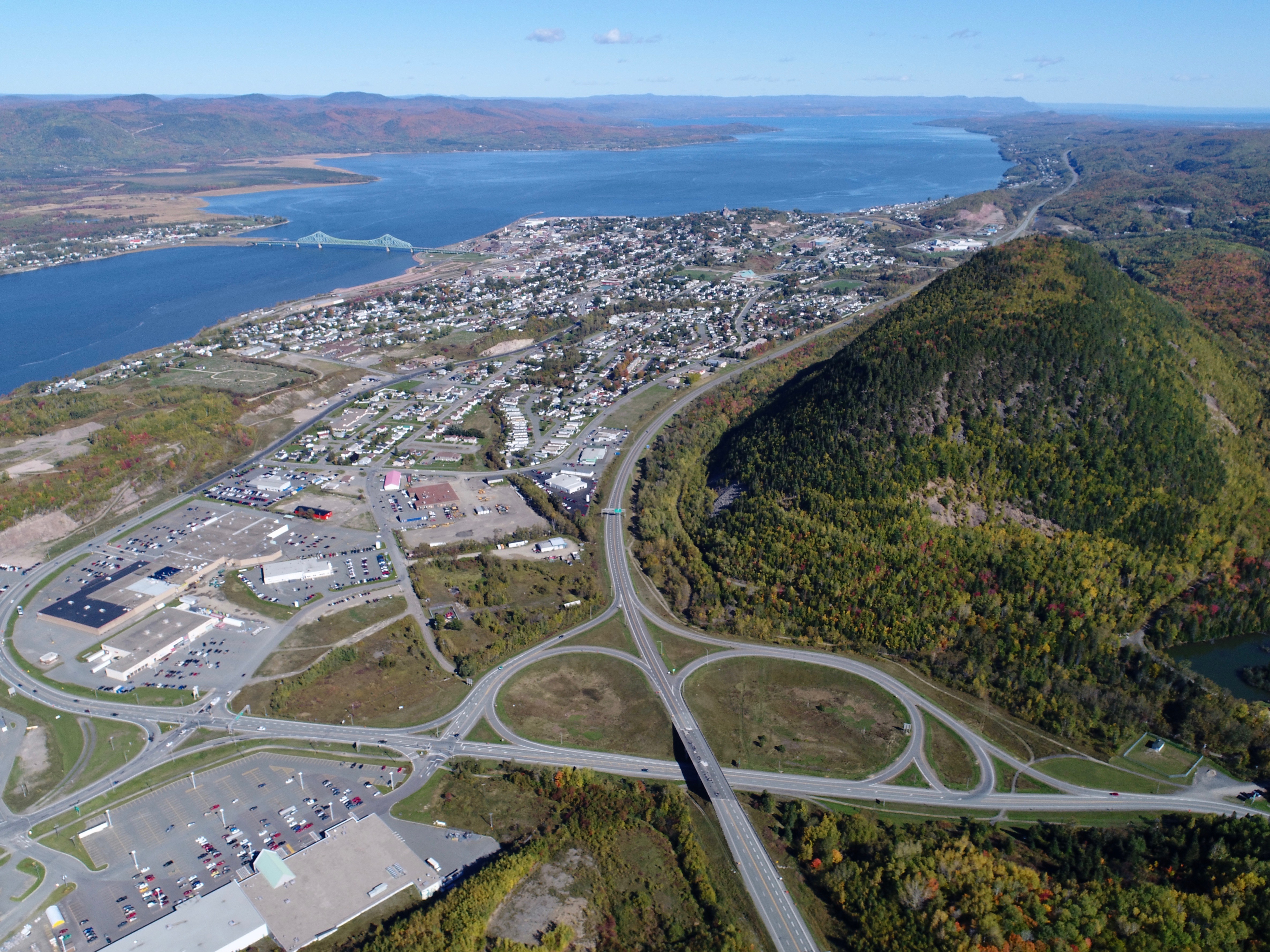
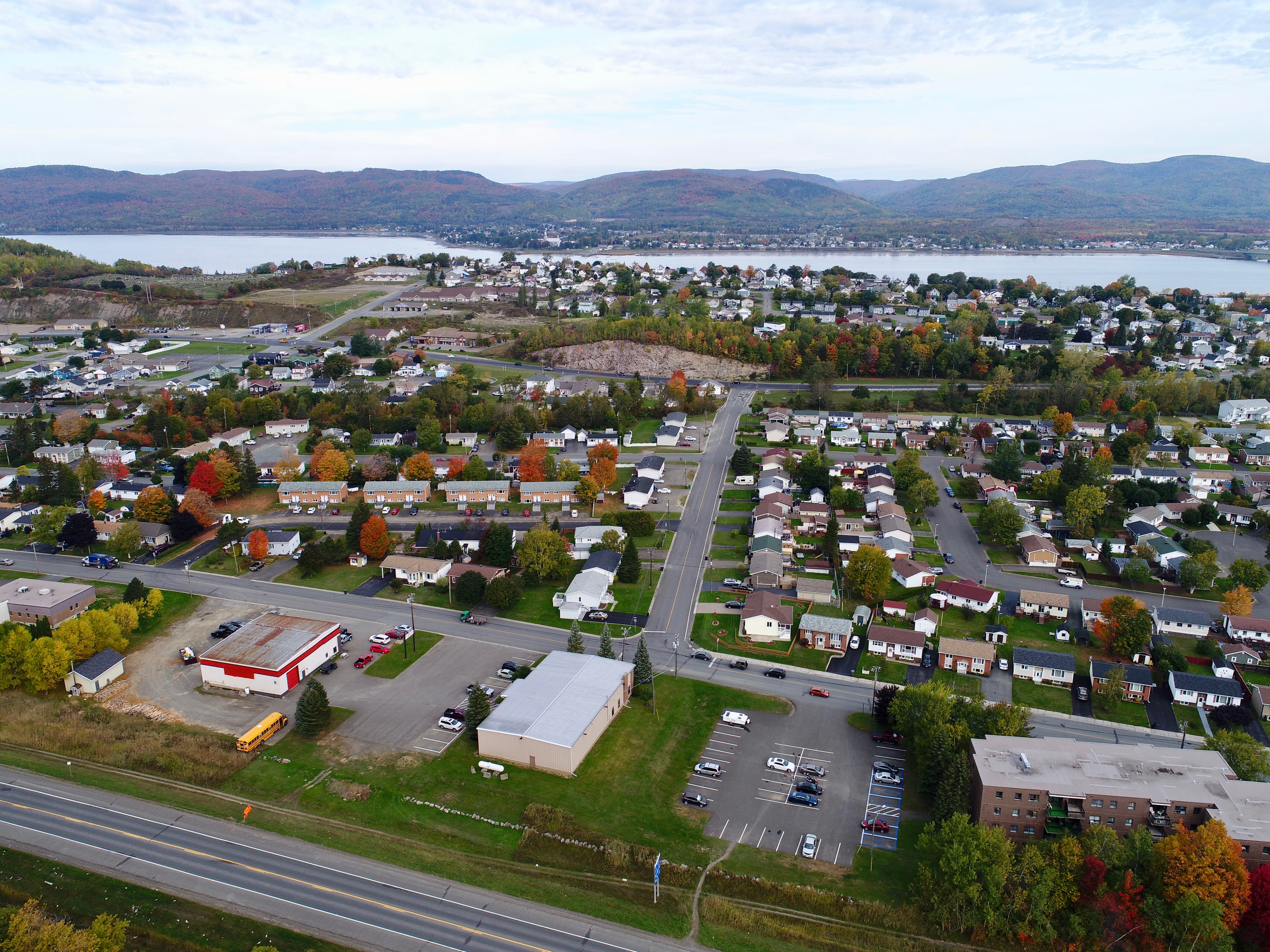
15. Campbellton [and part of Atholville] looking from west to east. The half cloverleaf is impressive. Take that, LA. [October 2017]
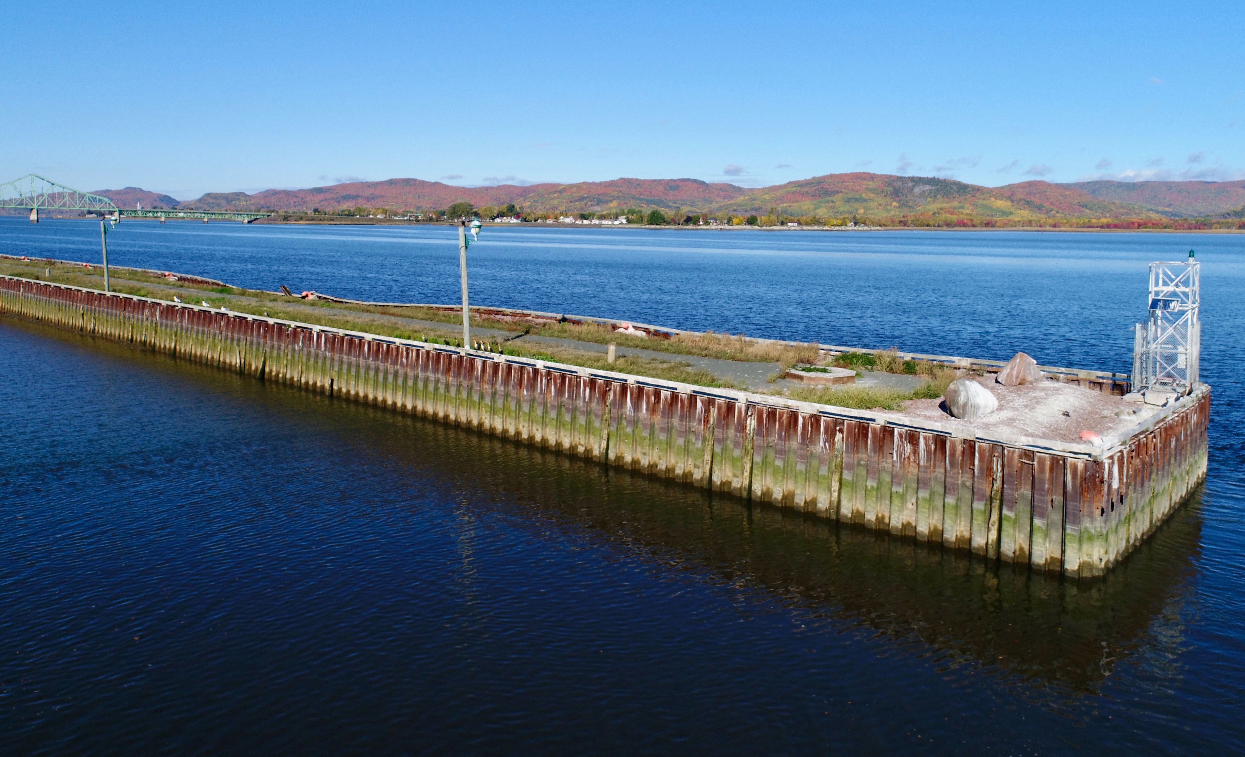
16. Campbellton’s wharf … in its day, a hub of activity with ships coming and going — but currently shut down.
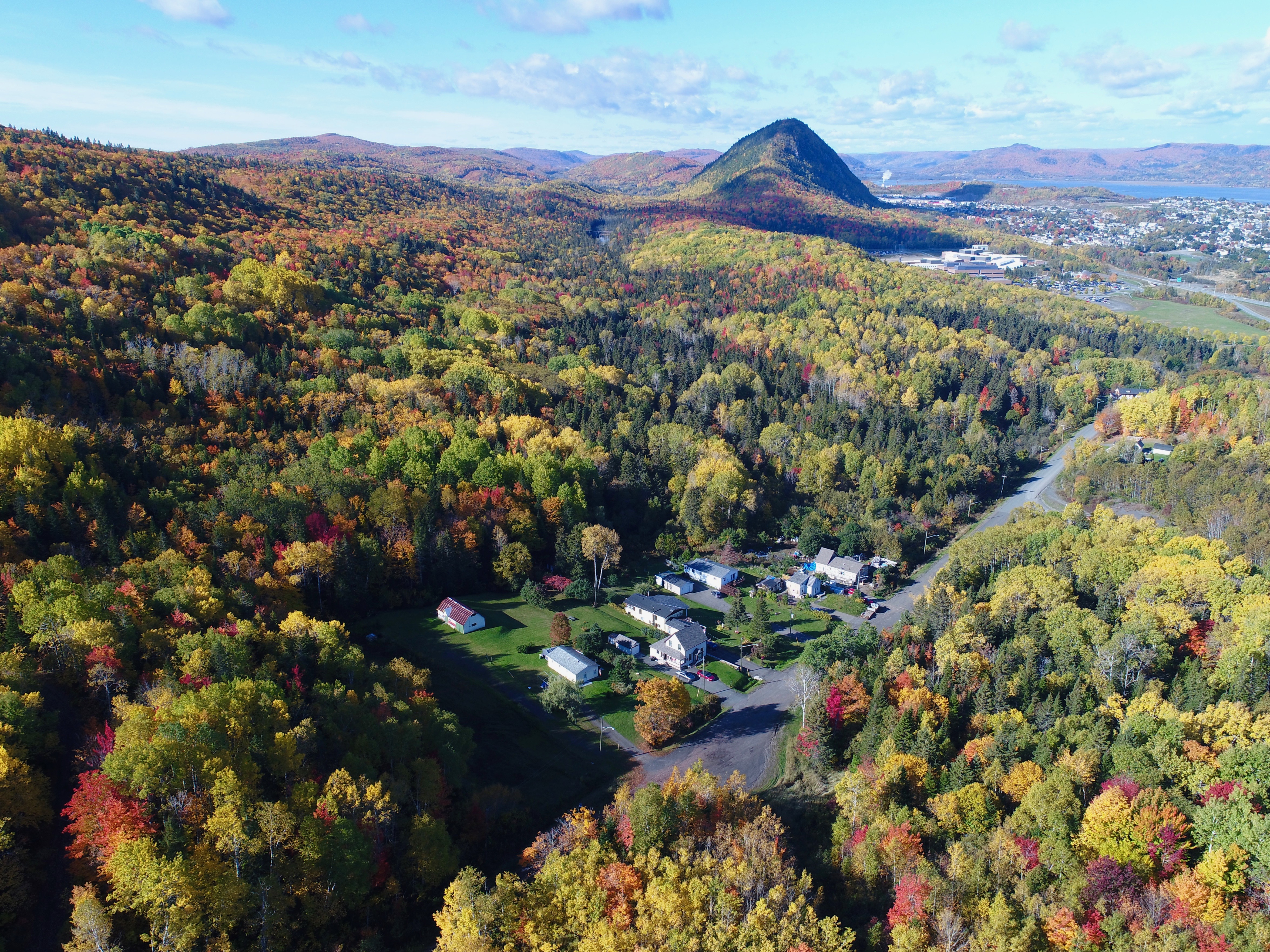
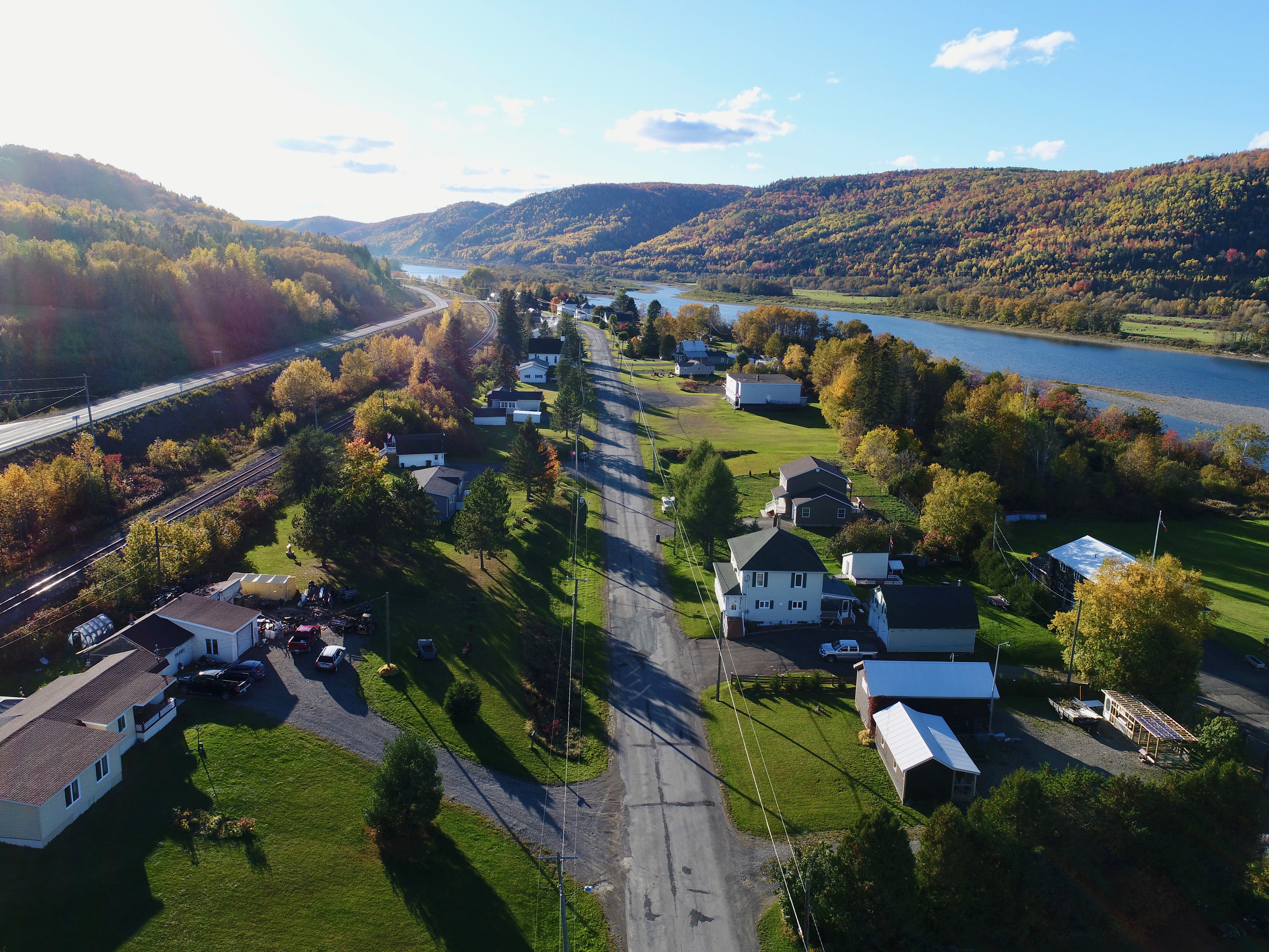
17. Lilly Lake Road, Campbellton’s very own satellite community. [October 2017]
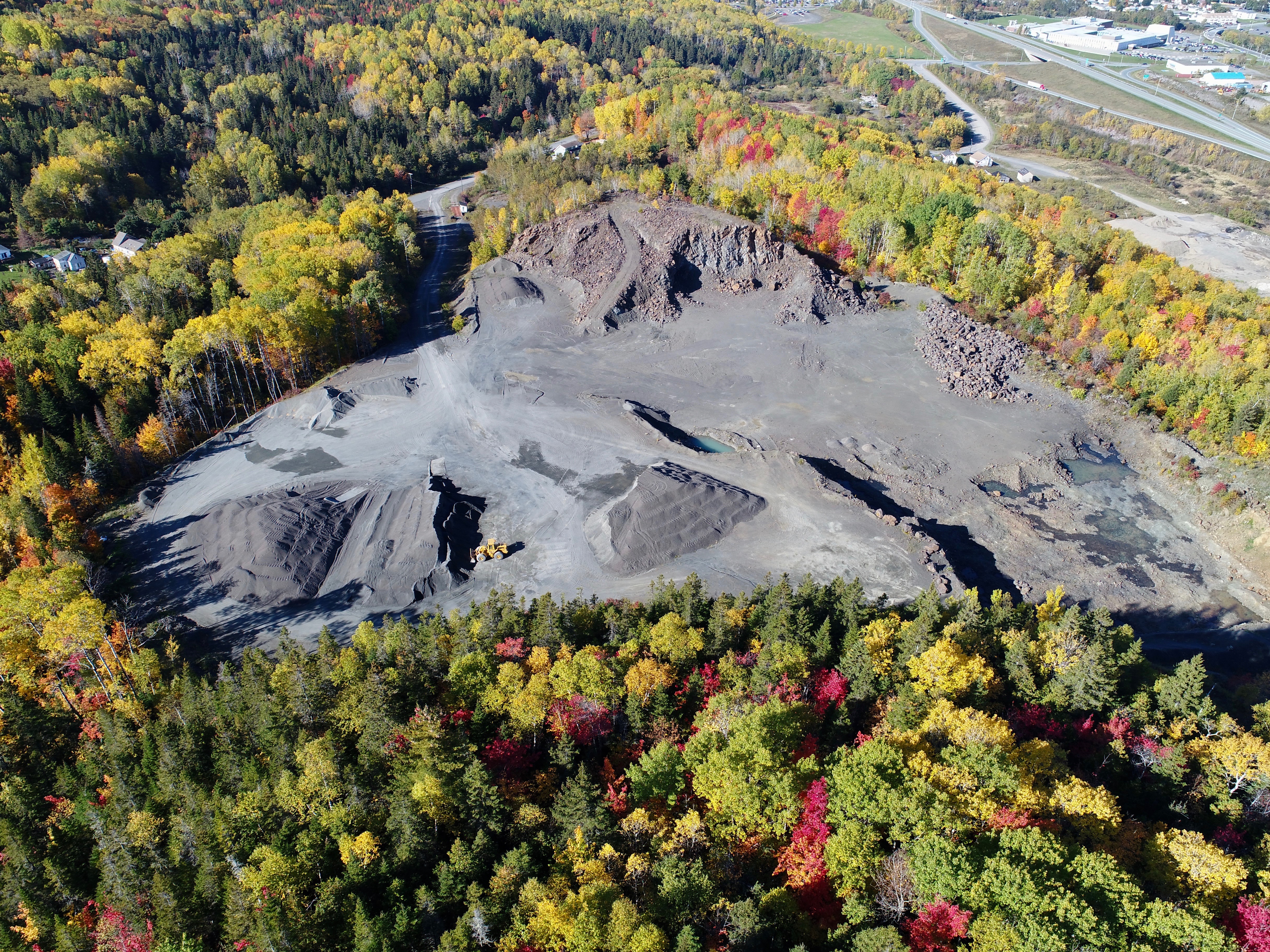
18. Beauty and blight. The seldom-seen quarry just off Lilly Lake Road. The yellow payloader looks like a toy. [October 2017]
19. Harvey Meadows subdivision. Half a century ago, some of this was a race track. [October 2017]
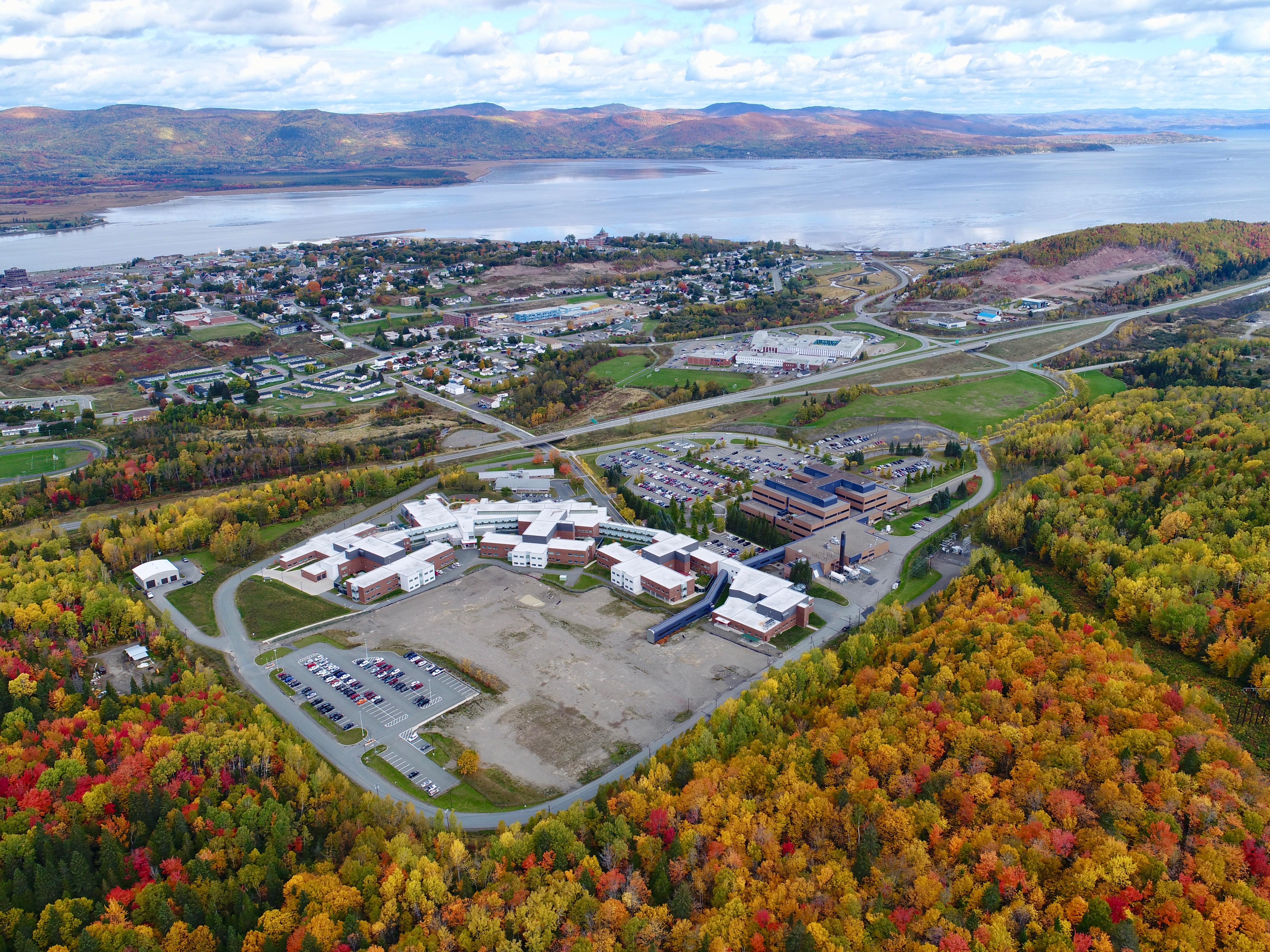
20. Another sprawling provincial complex — this one for health care — the Campbellton Regional Hospital [includes a regular hospital, psychiatric facility and an addiction treatment centre]. Directly west of this multiplex is the Terry Fox Memorial Trail. [October 2017]
21. Ever been to the lookout at Pointe-a-la-Croix, Quebec? One can drive most of the way up — but it helps to have a 4-wheel drive. Very rough road. [October 2017]
21b. There’s something very Claude Monet about this photo. A parking area about .2 km from the summit. ATV trails all over the place. [October 2017]
22. The western edge of Listuguj, a sawmill and a gravel road that leads to Indian Lake. [October 2017]
23. And this is Indian Lake. Seen from the side, it looks a bit like the outline of Australia. [October 2017]
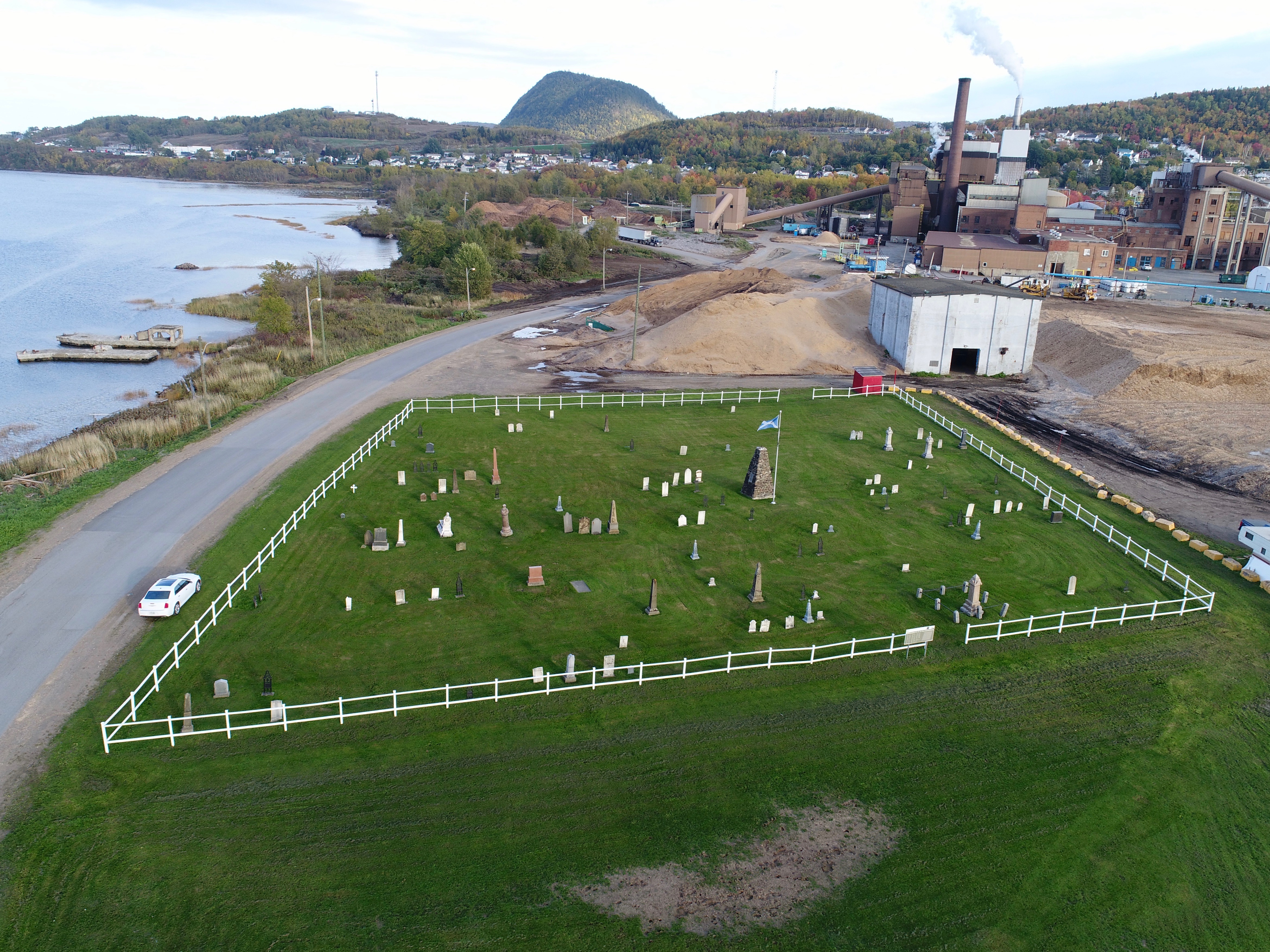
24. Atholville: Here we find graves of the first European settlers to the region. The historical cemetery is sandwiched between the Restigouche River and the Pulp Mill. Some of those buried here were born in the 1700s. [October 2017]
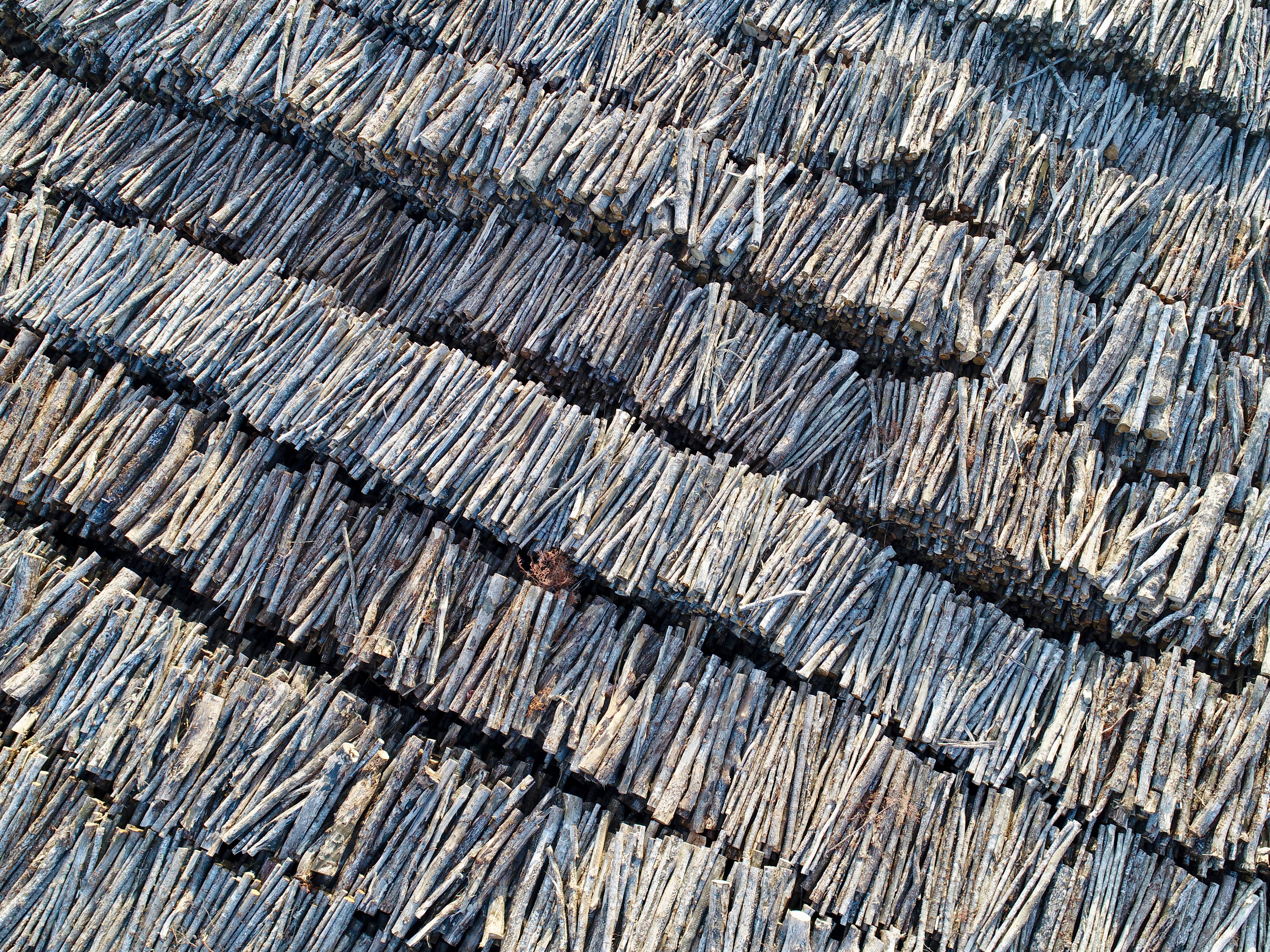
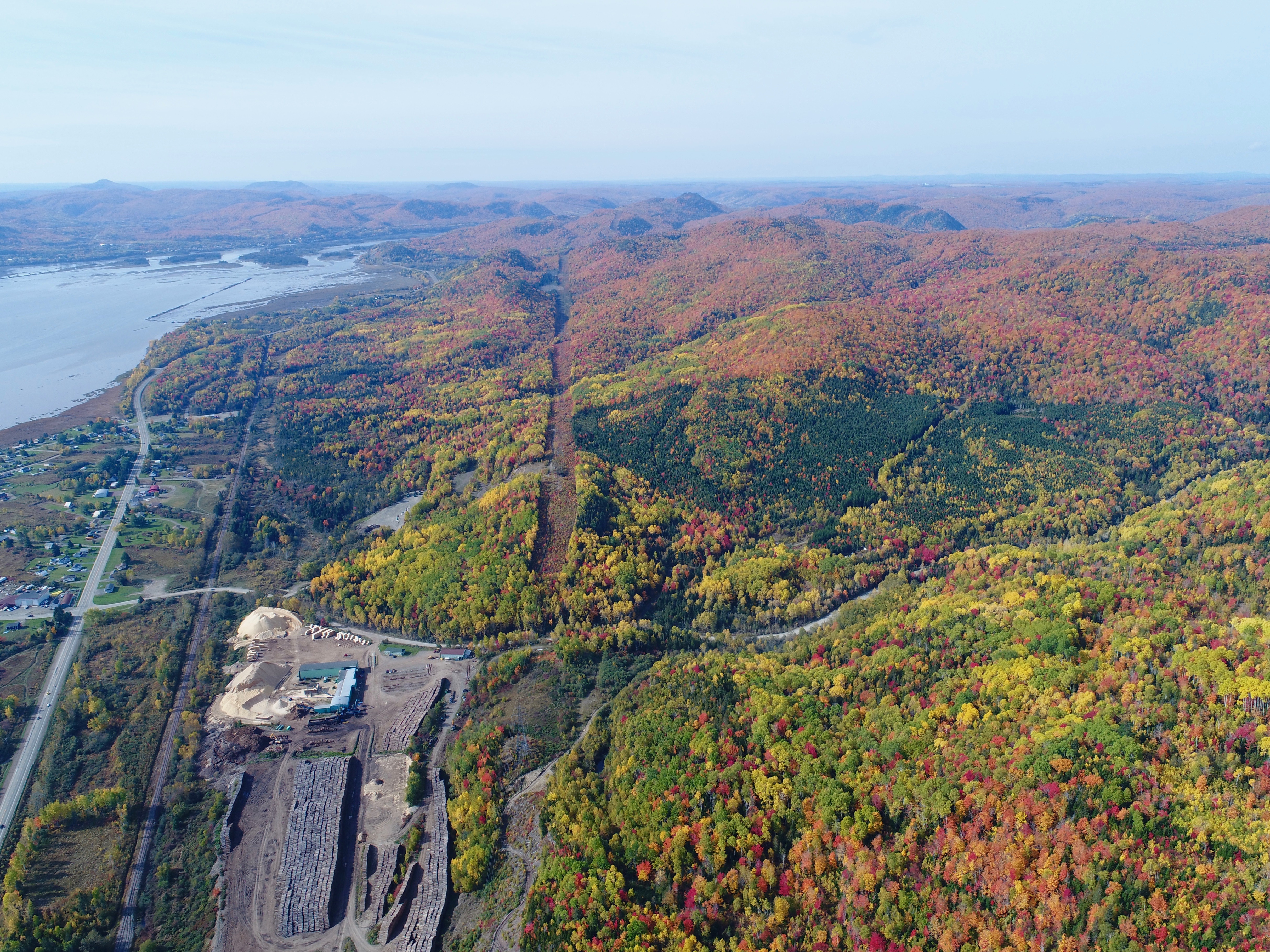
25. At the pulp mill in Atholville: Tens of thousands of large logs — ex-trees — about to be turned into pulp, then paper. The stack is 20-25 feet high. This is an overhead shot, not a side view. [October 2017]
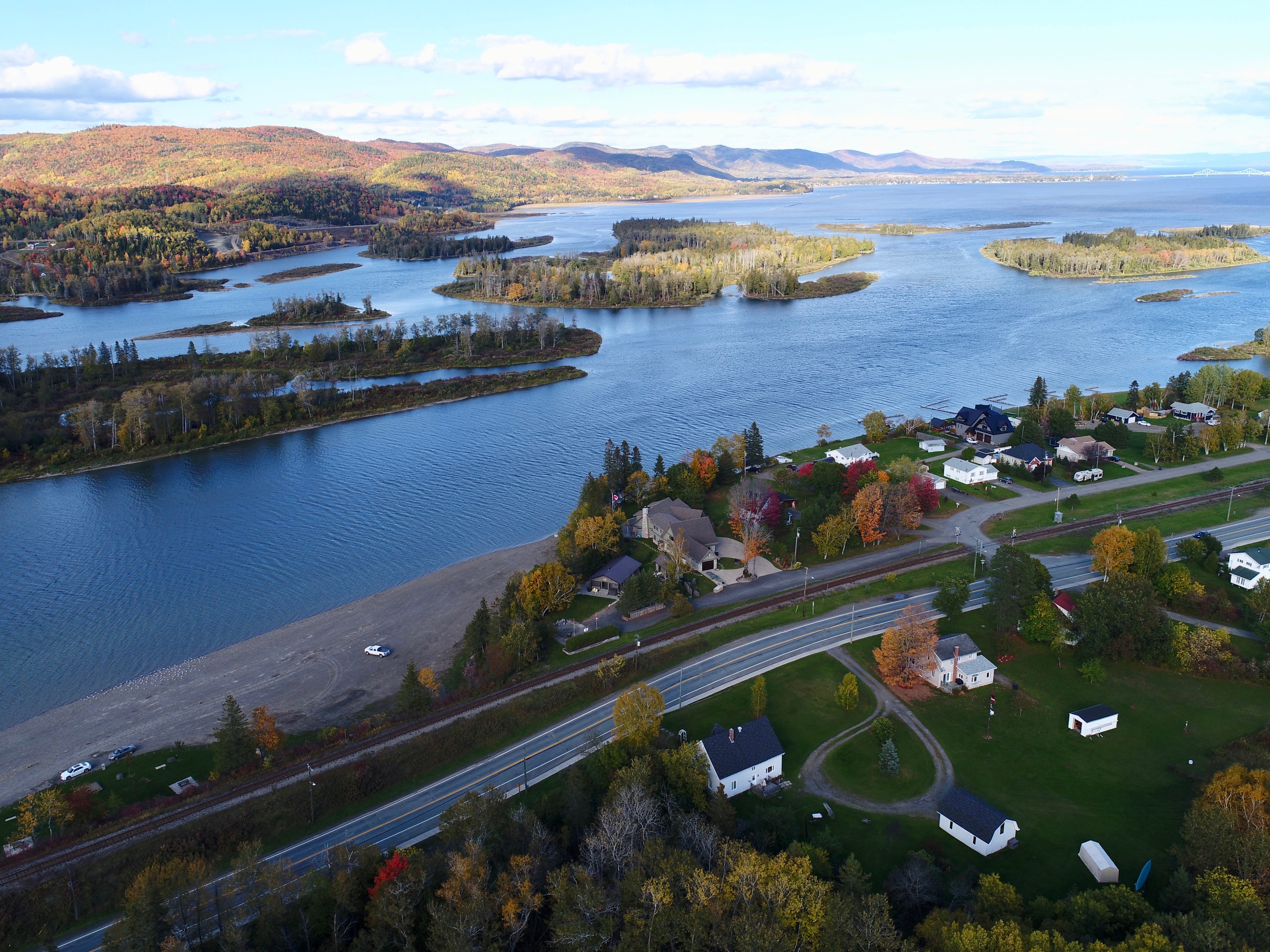
26. Tide Head Beach and its famous islands — home to so many delicious fiddleheads. [October 2017]
27. Tide Head … lower-left is Christopher Brook. Embedded in the front lawn of the white house [lower right] are cannonballs from the Battle of the Restigouche [England vs France] in 1760. That’s what’s wrong with the world today … no one fires off cannonballs anymore. [October 2017]
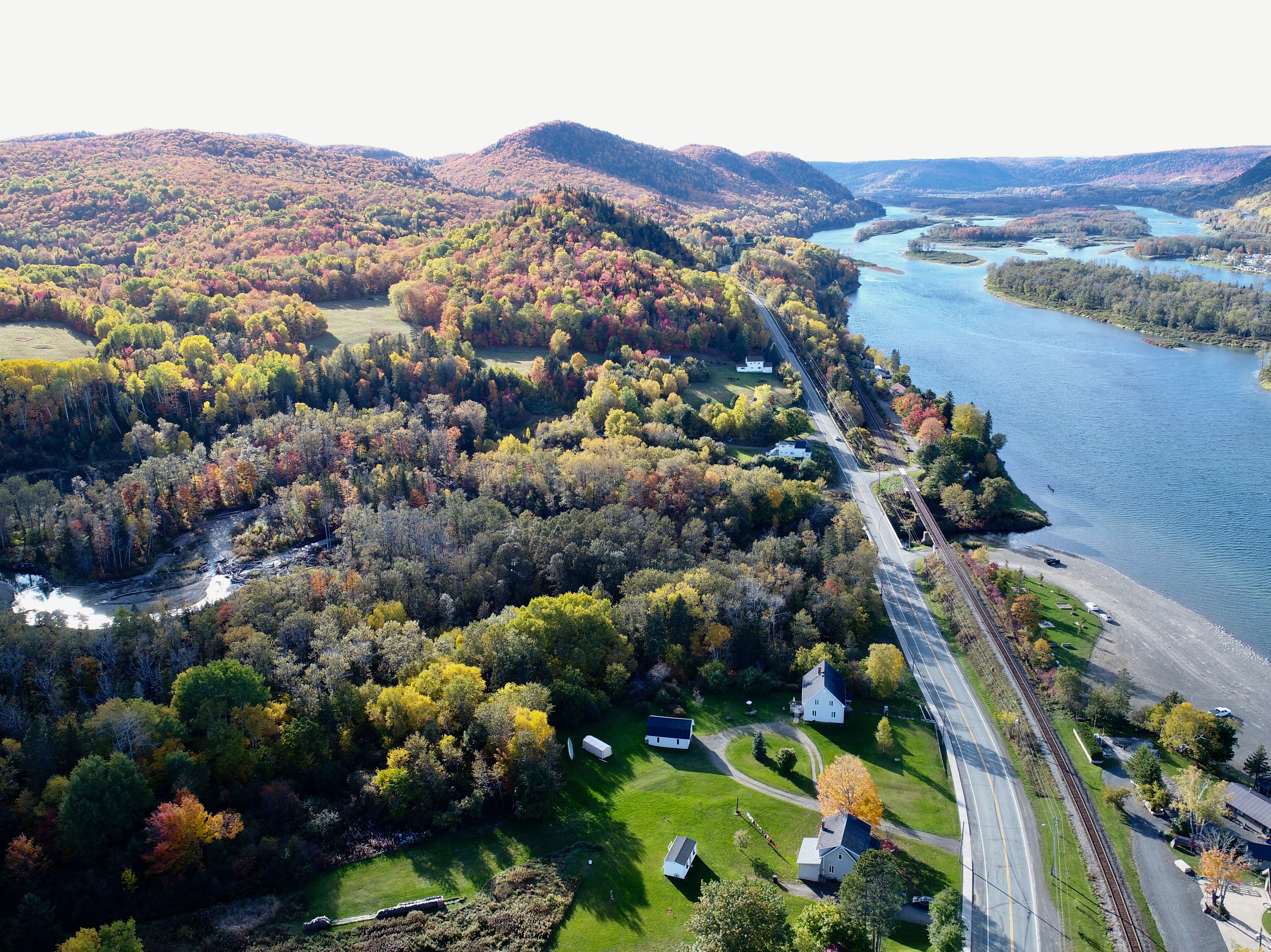
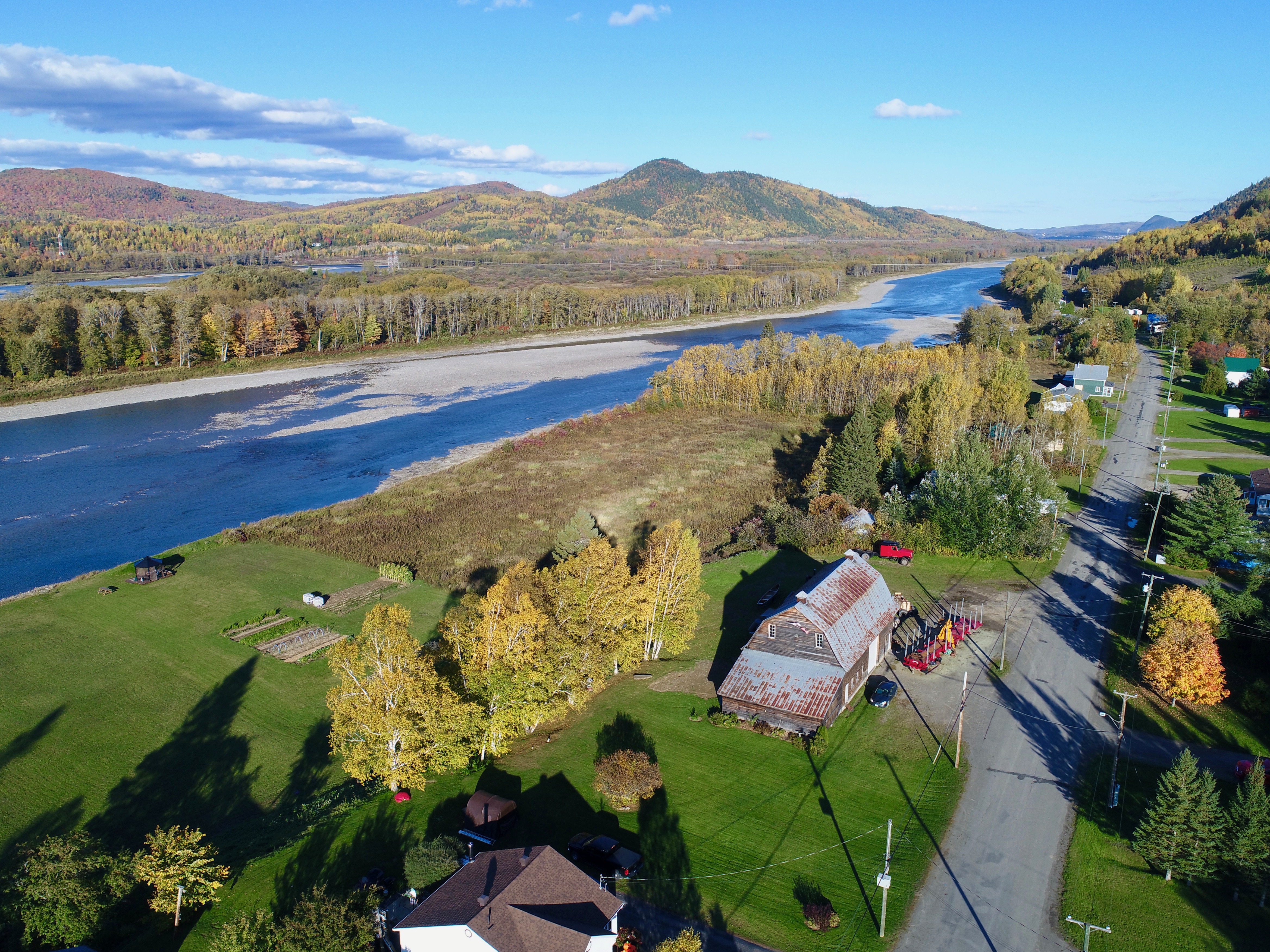
28. More Tide Head … notice Sugarloaf Mountain 5 miles distant. [October 2017]
29. More of the Islands just west of Tide Head … some of these are privately owned. Quebec to the left, New Brunswick to the right. [October 2017]
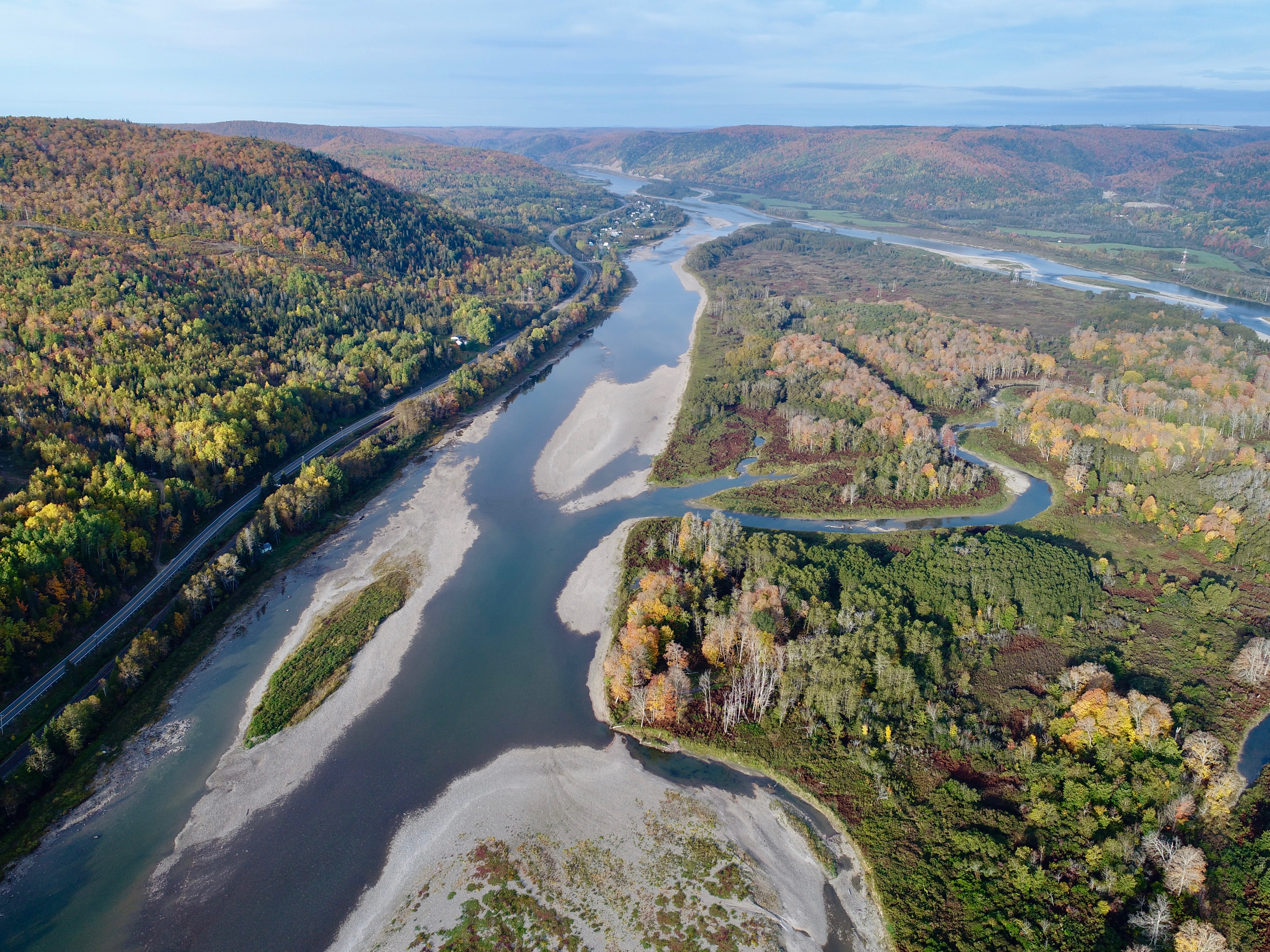
30. The water is low this year. Wow. Check out those sandbars. [October 2017]
31. Flatlands, looking east … see the Sugarloaf? It may be the most photographed mountain in Atlantic Canada. [October 2017]
32. Casting long shadows, the evening sun sets on Flatlands. This is looking west towards the Matapedia Valley. [October 2017]
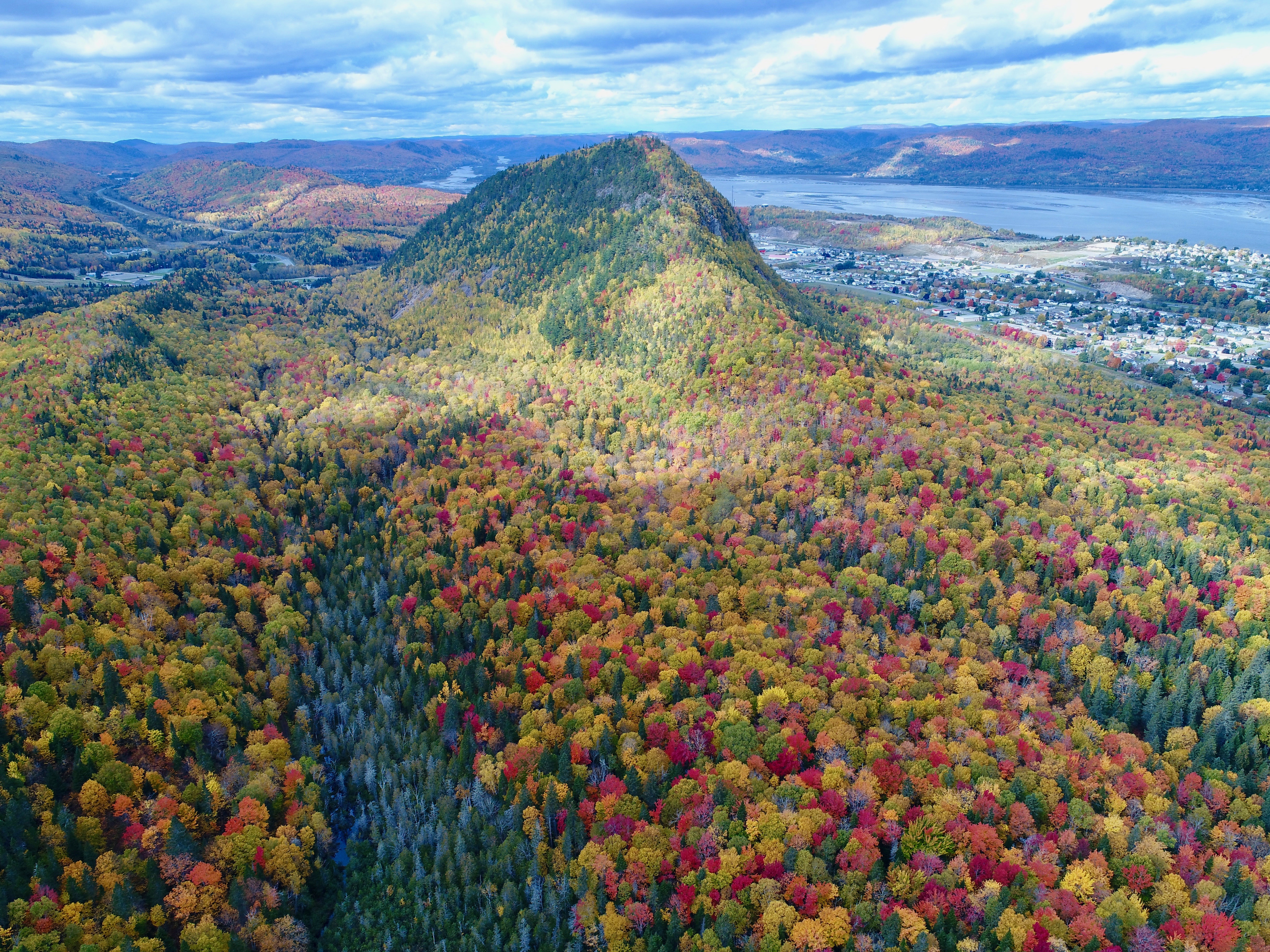
33. Sugarloaf Mountain, Restigouche River and thousands of trees in a spectacular show-and-tell. [October 2017]
Finally … a 1:27 video with music [‘Autumn Hill’] by Jon Hopkins.
Click on the arrow to see the clip in 720p quality — but for 1080p quality [sharper, showing more detail] click on ‘share’ in the top right, then click on either ‘Original’ or ‘MP4’.
If you’d like to download the video, click on ‘share,’ then on ‘OGG.’
YouTube …
This is the same video — but in better resolution — and it’s on YouTube.
Choose the highest resolution possible by going to the gear icon at the bottom. Then go ‘full screen’ by clicking on that squarish-looking icon, bottom right.
Credit …
All images were by the Author. Special thanks to John Van Horne, Darlene Firth, Rose Beek, Mark Ramsay, Debra Kean, Barbara Kean, and Don Hume.

This video certainly does justice to an awesome view of natures beauty. Spectacular! Well done.
LikeLike
My lifetime love affair with NB started circa 1958 working as a young Canadian Bridge Company Project Engineer on Fredericton’s Princess Margaret Bridge then continued on up to the Campbellton/Cross Point bridge circa 1960 — where I spent the happiest year of my life — having met/married a local girl of my dreams, worked on a dangerous job — all the while partying like there was never a tomorrow.
Actually knew Charlie Van Horne at the time — have a great story about the day we finally connected both sides over the water — it was a late Thursday afternoon and because of Charlie’s shenanigans, I never saw my crews again until the following Monday!
Over the ensuing years, I kept coming back to Campbellton yearly (until recently) reliving the memories of what turned out to be my personal NB Camelot.
Your photos are unique and beautiful and serve only to whet my appetite for perhaps one final trip to that place where my life’s voyage really bloomed.
Thanks for the reminders.
LikeLike
Most beautiful photos. Thank you.
LikeLike
Thank you so much … made me feel like I had been flying. I need to get back to my kitchen. LOL.
LikeLike
Super shots.
LikeLike
This video and these photographs are amazing.
I have been away for a long time and it’s a perfect representation of ‘home.’
Thank you!
LikeLike
Love this video — I lived in Campbellton in my childhood until I left at age 28.
I’ve climbed the Sugarloaf about 10 times and was part of the celebrations of the Van Horne bridge.
LikeLike
Outstanding photo essay Byron! A real pleasure to view.
LikeLike
This is a keeper for all ex-Campbelltonians to remind us how fortunate we were to have lived in this little corner of Heaven.
LikeLike
Love the photos! You never stop, do you?
LikeLike
The best photos of the area I have ever seen — or taken. Many thanks for doing them.
I grew up on Arran Street, just in front of the Sugarloaf.
LikeLike
Every time I see your videos and pictures of Campbellton, I realize how lucky I was to grow up and live in my hometown.
Thanks for sharing.
LikeLike
WOW … these are just wonderful pictures, thanks for sharing.
Growing up in Campbellton was like living in paradise.
LikeLike
Wish I would have known you were going to be in Campbellton. Ann and I were just there at the beginning of the month. We could have delayed our trip a bit so we could have met up with you.
Nice photos!
LikeLike
Ah … beautiful. Thank you…made my day.
I’m so, so thankful to have grown up in Campbellton. The pictures bring back many wonderful times, good neighbors, great schools, etc.
LikeLike
Beautiful photos — the Flatlands pics especially — since I was a kid there in the 1950’s. We lived just east of upper tracks, across from the two big white houses on the right.
My ashes will be scattered there. And you can see why, my friend. It’s my home.
LikeLike
Never gets old!!! I suppose if we were actually there right now, and freezing our ta’s ta’s (as Hank’s sister Lucille is constantly reminding us), we might feel differently … but????
In my mind, Campbellton has always been magical and will be until I enter that big Wigwam in the sky — which now at the big 86 is a lot closer than I like to think.
LikeLike